
With the addition of Vricon’s unique 3D capabilities, Maxar will unlock a new dimension of information that will enhance the utility of the company’s imagery for customers, as well as meet the requirements of future technology and machine learning applications.
 Figure 1.
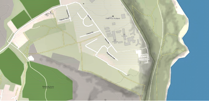
Figure 2.
Now that Vricon’s products will be connected to Maxar’s entire 110-petabyte imagery archive, there will be faster, scalable production with global availability. With WorldView Legion, the imagery refresh rate and subsequent derived 3D models will allow customers to truly keep up with our changing planet at an unprecedented speed in the industry.

Information derived from the third dimension is similar to the depth of information gleaned from skimming an outline versus an in-depth read of a publication. Let’s take, for example, the following evolution of mapping information as a roadmap as to how each new layer of information significantly improves the utility of the map.
A basic 2D map is shown in Figure 1, which is great for positional location and relative distance from one feature to another.
If we add terrain shading and contours to the map, as shown in Figure 2, we now get a basic understanding of topography.
Electro-optical imagery allows identification of the features on the map, so the characteristics of the buildings and the surroundings now are recognizable and distinguishable, as shown in Figure 3.
Finally, with 3D data, the map now comes to life providing a bird’s eye view where all features are recognizable, and the dramatic changes of the topography are plainly apparent (Figure 4).
However, Vricon’s technology goes beyond enhancing our mapping capability. The derivatives created from the Vricon 3D Surface Model such as Digital Surface Model (DSM), Digital Terrain Model (DTM), and 3D Vectors are critical to the advancement of emerging technologies such as 5G signal propagation, autonomous vehicles, smart cities and internet of things (IoT), as well as guided munitions and disaster response planning and mitigation.
3D Mapping
3D maps have become a foundational source of information for a range of visual and analytical applications. However, traditional sources of 3D information have been ineffective due to their limits in geographic scale, accuracy and currency.
Customers need precise 3D information to understand where and how to deploy resources.
For example, with the growth of 5G telecommunications, network planners and operators use propagation modeling software that needs exact information about urban, suburban and rural environments to deploy infrastructure in an effective and efficient manner. Civil and local governments use hydrological and simulation modeling software that requires highly accurate 3D models to assure proper emergency planning and response efforts.
Derivative datasets from the core Vricon 3D Surface Model enable infrastructure and resource planning activities in a more timely and cost-effective fashion than existing, manually produced methods.
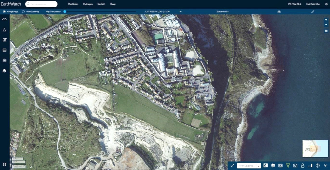 Figure 3.
 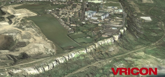 Figure 4.
Military Simulation + Virtual Training
Faced with sophisticated adversaries, today’s warfighter requires familiarity with an area before deployment.
Training, planning and rehearsal demand realistic 3D situational awareness—as well as the ability to georegister disparate information sources. Visualization is critical to success, yet traditional approaches are limited in scale and/or quality.
Vricon’s accurate and realistic 3D representation of global battlefield environments enable life-like flight simulations and precise environments to train and simulate mobility and tactical planning.
As proof of the importance of a synthetic training environment to the modern military, the U.S. Army awarded Vricon a $95 million contract for One World Terrain in 2019.
Figure 5. Image credit: Maxar Technologies
Precision-Guided Munitions
The current workflow for the extraction of precision coordinates is time consuming and inefficient. Vricon’s 3D technology will drive tremendous efficiency improvements to the mensuration process by enabling users to extract x, y and z coordinates in a fast and reliable manner.
An Accurate Foundational Layer for all EO Data
With the proliferation of geospatial data and new sensors constantly expanding, there has never been a more pressing need for a common alignment layer for all Earth Observation (EO) data. Having a highly accurate foundational layer will enable customers to fully leverage the information captured within these images as well as the effectiveness of artificial intelligence (AI) to produce consistent results.
Leveraging the technology behind Vricon’s Precision 3D Registration (P3DR), Maxar will be able to positionally correct all 2D images to become the geospatial reference standard for existing and next-generation location-based applications, accelerating the creation of a living digital model of the Earth—a concept we call The Digital Globe™.
Learn more about the full Vricon 3D product portfolio via this direct infolink...www.maxar.com