
Exelis—Providing Sim Data For GPS III
Exelis has successfully completed factory acceptance testing for the Global Positioning System (GPS) III navigation payload simulator software.

Artistic rendition of a GPS III satellite.
Developed by Exelis, the software will simulate the behavior of GPS signals in space, which will be used for testing the U.S. Air Force’s next generation GPS ground station known as the operational control system (OCX).
The simulator will be integrated into the Raytheon-developed GPS System Simulator (GSYS) within OCX.
“The simulator models the navigation payload function and interface with OCX,” said Kevin Farrell, positioning, navigation and timing general manager at Exelis Geospatial Systems. “It provides simulation data representative of multiple GPS III space vehicles at the level needed to support control segment test events, mission rehearsals, and anomaly investigations, ensuring that the OCX control system is properly functioning before launching into space.”
Awarded in February 2010 by Raytheon, Exelis is on contract to provide critical software elements in the navigation processing subsystem to enable GPS constellation controllers to better understand the satellites’ exact position.
This helps ensure accurate navigation information is being securely broadcast to users.
In addition, Exelis is building high-precision receivers for use in ground monitoring stations placed strategically around the world and also builds data encryptors to ensure secure information exchange between the ground and space segments of the system.
As part of the GPS modernization effort, Exelis is also on contract with Lockheed Martin to provide payloads for GPS III satellites.
Exelis is a major space technology provider, supporting both the satellite and ground portions of the GPS III modernization program.

For nearly 40 years, Exelis payloads and payload components have been on board every GPS satellite and have accumulated nearly 700 years of on-orbit life without a single mission-related failure due to Exelis equipment.
Once the new operational control segment is implemented, GPS will improve a variety of business and economic applications, including air traffic control, increasing crop yields, and monitoring environmental trends, among others.
The new capabilities offered by GPS modernization will also provide U.S. Air Force Space Command increased accuracy, availability, anti-jam power and international interoperability.
* * * * * * * * *
Service Chiefs Testify On Sequestration Risks
As they face the prospect of another year of deep cuts to their budgets, the military’s service chiefs testified before the Senate Armed Services Committee on the impact sequestration is having on the ability to organize, train and equip their service members.
Army Chief of Staff Gen. Ray Odierno, Chief of Naval Operations Adm. Jonathan W. Greenert, Air Force Chief of Staff Gen. Mark A. Welsh III, and Marine Corps Commandant Gen. James F. Amos told lawmakers sequestration portends a hollow force, greater risk of coercion and fewer options to handle global adversaries.
General Raymond T. Odierno U.S. Army Chief of Staff
Odierno urged all military leaders and lawmakers to keep foremost in their minds the impact budget shortfalls have on soldiers who are asked to protect the nation.
“They are national treasures and their sacrifices cannot be taken for granted,” Odierno said. “They are not chess pieces to be moved upon a board—each and every one is irreplaceable.”
Odierno added, “We are drawing down our Army not only before a war is over, but at a time when unprecedented uncertainty remains in the international security environment.”
The total Army—active duty, Guard and Reserve—currently remains heavily committed in operations overseas and at home. “More than 70,000 U.S. Army soldiers are deployed to contingency operations with nearly 50,000 soldiers in Afghanistan alone,” Odierno said. There are more than 87,000 soldiers forward stationed across the globe in nearly 120 countries, he added. During his 37 years of service, Odierno said the Army has deployed soldiers and fought more than 10 conflicts, including Afghanistan, the longest war in the nation’s history.
“No one desires peace more than the soldier who has lived through war,” he said. But with a looming drawdown and the restructuring of the Army into a smaller force, the general explained, the service will experience degraded readiness and extensive modernization shortfalls. “We’ll be required to end, restructure or delay over 100 acquisition programs,” Odierno said. Personnel cuts will also take a toll, the general said.
“The Army will be forced to take additional end-strength cuts to no more than 420,000 active duty, 315,000 Army National Guard and 185,000 in the U.S. Army Reserves,” Odierno said. “This will represent a total Army end strength reduction of more than 18 percent over seven years—a 26 percent reduction in the active component—a 12 percent reduction in the national guard and a nine percent reduction in the U.S. Army Reserves.”
Odierno stressed that he does not consider himself an alarmist, but a realist. “In the end, our decisions today and in the near future will impact our nation’s security posture for the next 10 years,” he said.
The Navy, too, will have to make strategic choices, operating where and when it matters to respond to contingencies with acceptable readiness, Greenert said. He noted current hot spots such as North Korea, Egypt and Syria.
“This ability to be present reassures our allies and [ensures] that U.S. interests around the world are properly served,” Greenert said.
Sequestration in 2014, Greenert warned, will further reduce Navy readiness and the service’s ship and aircraft investment as the service attempts to maintain a sea-based strategic deterrent and sustain a relevant industrial base and an appropriate forward presence.
Admiral Jonathan W. Greenert Chief of Naval Operations
Greenert said most concerning is the reduction in the Navy’s operations and maintenance budget, which will result in only one non-deployed carrier strike group and one amphibious ready group trained for contingency response.
Greenert said this will fall short of the Navy’s covenant with combatant commanders—the provision of at least two carrier strike groups, two amphibious ready groups deployed and another three of each in and around the continental United States for short-notice response.
The budget fallout also ensures a continued hiring freeze for most of the Navy’s civilian positions, degrading the distribution of skill in the workforce, the admiral said. Greenert recommended Congress allow the Navy to transfer money between accounts as one way of mitigating the situation.
“This would enable us to pursue innovative acquisition approaches, start new projects, increase production quantities and complete the ships that are under construction,” recommending the transfer of about billion dollars each into his service’s operations, maintenance and procurement accounts.
Similarly, Amos, the Marine Corps commandant, described readiness sustainment within the current fiscal environment as a “mortgage” of tomorrow’s readiness, infrastructure sustainment and modernization.
“We are ready today because your Marines are resilient and determined to defend the United States of America,” Amos said. “We are funding today’s readiness by curtailing future investment in equipment and in our facilities.”
Amos expressed his displeasure over last month’s furlough of some 14,000 Marine Corps civilians.

General James F. Amos Commandant of the U.S. Marine Corps
Since sequestration began in March, Amos said he has realigned funds within his authority to maintain unit readiness to the highest extent possible.
“My priorities have remained consistent: first and foremost, the near-term readiness of forward deployed forces, followed by those that are next to deploy,” he said.
The commandant reported that the Marine Corps is currently spending about 16 percent of what is required “bare minimum” to maintain barracks, facilities, bases, stations and training ranges.
“This is unsustainable and it can’t continue over the long term.”
To meet the requirements of future conflicts, investments in modernization, infrastructure and people are critical, he said.
The defense strategic guidance calls for 186,800 active duty Marines, which enables the Marine Corps to meet steady state operations and fight a major war, and preserves a 1:3 dwell time for Marines and their families.
A force of 174,000 Marines, which sequestration will require, drives the service to a 1:2 dwell, or 6 months deployed with 12 months of recuperation and training, Amos said.
“This is dangerously close to the same combat operational tempo we had in Iraq and Afghanistan while fighting in multiple theaters and maintaining steady state amphibious operations around the world,” Amos said. “This is a formula for more American casualties.”
In the Air Force, Welsh described the impacts of sequestration as sobering and warned that the service will be forced to cut flying hours to the extent that in coming years many flying units won’t be able to retain mission readiness.

General Mark A. Welsh, III Chief of Staff of the U.S. Air Force
“We’ll cancel or significantly curtail mission exercises again,” Welsh said. “And we’ll reduce our initial pilot production targets which we were able to avoid in FY 13 because prior year unobligated funds helped offset about 25 percent of our sequestration bill last year.” Those funds; however, are no longer available, Welsh said.
The Air Force hopes to build a viable plan to slow personnel and infrastructure costs when able, he said. Yet, the only way to pay the full sequestration bill, he added, is to reduce force structure, readiness and modernization.
“Over the next five years, the Air Force can be forced to cut up to 25,000 airmen and up to 550 aircraft, which is about nine percent of our inventory,” Welsh said. These cost savings, he said, could force the Air Force to divest entire fleets of aircraft.
Meanwhile, Air Force officials will prioritize, focusing on long-range capabilities, readiness and full-spectrum training, Welsh said.
“We’ll favor recapitalization over modernization, which is why our top-three acquisition programs remain the F-35, the KC-46 and the long-range strike bomber,” Welsh said.
Story by Amaani Lyle, American Forces Press Service
* * * * * * * * *
ANG + JCSE—Adapting To Fluctuating Requirements
A team of highly-trained and experienced joint communicators from the 224th Joint Communications Support Squadron, a Georgia Air National Guard unit aligned with the Joint Communications Support Element (JCSE), completed a four-month deployment in support of Pacific Partnership 2013 (PP13).

Teams of medical, dental, veterinarian and engineering professionals traveled to six island nations in the Indo-Asia-Pacific region aboard the USS Pearl Harbor to enhance disaster response preparedness. These teams also completed service projects in their respective fields to strengthen local stability and regional infrastructures in case of natural disasters.
The JCSE team provided ship-to-shore connectivity and on-the-spot communications solutions—an integral piece of this mission. Not only did JCSE’s extensive expertise and versatile communications equipment demonstrate the command’s unique capabilities, but the team maintained vital communication services for PP13 participants.
The JCSE team employed four Initial Entry Packages (IEP), a commercial airline checkable equipment set that supports up to eight users, to provide the unclassified voice and data networks for the PP13 teams. At each port call JCSE’s support provided mission-critical connectivity to beach detachments responsible for the movement of personnel on and off the ship. Their support also ensured the medical teams at various sites ashore had open lines of communication to reach back to doctors on the ship, better serving patients’ needs.
In addition to this routine support, this mission also required JCSE’s communications experts to adapt to fluctuating necessities. The team’s in-depth understanding of the communications equipment and the operational environment allowed them to rapidly modify their capabilities to address short-notice communication requirements.
“Due to the ample amount of training and real-world experience we have on our compact and portable communication packages, we were able to think outside of the box and better serve the needs of the mission,” said JCSE member U.S. Air Force Staff Sgt. Neil Howard.
For instance, JCSE’s highly mobile communications support was specifically requested by the PP13 mission commander, U.S. Navy Capt. Wallace Lovely, as he traveled to Papua New Guinea in advance of the scheduled port visit by the Australian ship HMAS Tobruk for formal engagements with key leaders and mission partners. From June 22 - 30, Howard traveled with Lovely and provided communication services to multiple users over the course of the trip using a scaled down version of the IEP.
“By using components of the IEP we created our own ‘communications-on-the-fly’ kit to travel as light as possible and provide uninterrupted communications to Captain Lovely and monitor network reliability for his advanced team,” said Howard. “We traveled 1,000 miles away and I only carried my rucksack, my backpack and my light-weight portable communications kit and a wireless router.”
Another instance of JCSE’s flexible, mission-tailored support took place at the mid-point of the deployment during a port call in the Marshall Islands. In the midst of providing communications support for a high-level engagement ceremony on board the ship, an engineering team in the field urgently requested JCSE’s support after losing connectivity.
An additional two-man JCSE team was sent to the engineering site to troubleshoot the cause of the interruption. JCSE’s instinctive ability to adapt and overcome communication issues was a key factor in the engineering team immediately regaining connectivity. JCSE’s flexible capabilities and scalable communication package proved to be a perfect fit for this incident.
The JCSE team’s expertise and flexibility in supporting the needs of PP13 contributed to mission success. After four-months abroad providing uninterrupted connectivity and demonstrating JCSE’s versatile capabilities, the JCSE team returns home thankful for this rewarding experience and proud that they supported such an extraordinary mission. After validating their extensive training and ability to adapt to challenges in the field, this JCSE team is even more prepared for future operational requirements.
Story by Julianne Sympson, Joint Enabling Capabilities Command
* * * * * * * * *
DARPA + SSL—Servicing PODS In Space
Many satellites in orbit are obsolete or have failed—yet all have usable components—however, currently, there is no way to use those components.

Artistic rendition of Phoenix satellite servicing vehicle. Image courtesy of DARPA + SSL.
Space Systems/Loral (SSL), a provider of commercial satellites, today announced that it has been selected to develop designs, processes and business terms for hosting free-flying science and technology missions on its geostationary (GEO) satellite platform.
Under the next phase of the U.S. Defense Advanced Research Projects Agency (DARPA) Phoenix program, SSL intends to develop detailed design and implementation processes and business terms for cost effective delivery of small spacecraft beyond Low Earth Orbit (LEO). In addition to its first use for the DARPA Phoenix mission, this capability is envisioned to enable numerous additional operational, science and technology space missions.
The goal of the revolutionary Phoenix program is to enable cost-effective repurposing of serviceable space hardware that is already on orbit. As part of the program, SSL aims to accommodate an ejectable hosted payload, called the Payload Orbital Delivery (POD) system, on a commercial GEO satellite. The POD would ultimately be released from the commercial spacecraft to accomplish its servicing mission in space.
“SSL is very pleased to participate in this innovative, affordable and sustainable access to space for the PODs that would supply and replenish the DARPA Phoenix architecture,” said John Celli, president of SSL. “DARPA’s vision and commitment to this capability could open the door to many other small satellite missions, enabled by frequent access to space on the SSL 1300 platform.”
SSL regularly works with a broad range of commercial satellite operators and has significant experience with hosted payload accommodation. For the DARPA Phoenix mission SSL intends to develop detailed plans and operating procedures for safe and accurate dispensing of the PODs from its 1300 satellite platform with minimal divergence from standard launch and orbit raising procedures. SSL also intends to work with DARPA to select the commercial host mission and develop the terms and conditions to incorporate POD ridesharing into standard commercial contracts.
Communication satellites in geosynchronous orbit (GEO), approximately 22,000 miles above the earth, provide vital communication capabilities to warfighters. Today, when a communication satellite fails, it usually means the expensive prospect of having to launch a brand new replacement communication satellite. Many of the satellites which are obsolete or have failed still have usable antennas, solar arrays and other components which are expected to last much longer than the life of the satellite, but currently there is no way to re-use them.

The goal of the Phoenix program is to develop and demonstrate technologies to cooperatively harvest and re-use valuable components from retired, nonworking satellites in GEO and demonstrate the ability to create new space systems at greatly reduced cost. Phoenix seeks to demonstrate around-the-clock, globally persistent communication capability for warfighters more economically, by robotically removing and re-using GEO-based space apertures and antennas from decommissioned satellites in the graveyard or disposal orbit.
The Phoenix program envisions developing a new class of very small ‘satlets,’ similar to nano satellites, which could be sent to the GEO region more economically as a “ride along” on a commercial satellite launch, and then attach to the antenna of a non-functional cooperating satellite robotically, essentially creating a new space system. A payload orbital delivery system, or PODS, will also be designed to safely house the satlets for transport aboard a commercial satellite launch.
A separate on-orbit ‘tender,’ or satellite servicing satellite is also expected to be built and launched into GEO. Once the tender arrives on orbit, the PODS would then be released from its ride-along host and link up with the tender to become part of the satellite servicing station’s ‘tool belt.’ The tender plans to be equipped with grasping mechanical arms for removing the satlets and components from the PODS using unique space tools to be developed in the program.
* * * * * * * * *
Green Hills Software + VIASAT—Security Solutions
Green Hills Software has an agreement to team with ViaSat Inc. to deliver military-grade security for Android smartphones and tablets.
The INTEGRITY® Multivisor™ separation-kernel has been selected as the hypervisor solution for the ViaSat Secured, a mobile enterprise system that addresses the stringent security, privacy, manageability, and usability demands for dual-use—personal and business—smartphones and tablets.
ViaSat Secured offers a carrier-agnostic suite of the latest and most popular mobile devices so that users may switch between personal and corporate use.
ViaSat Secured devices are pre-programmed with Green Hills Software’s INTEGRITY Multivisor, a foundational firmware layer of data protection and isolation below the mobile operating system, which enables either a secure single or dual persons solution that cannot be achieved with container-based offerings.
ViaSat Secured devices are managed with ViaSat network management, which includes firmware-over-the-air update (FOTA) and enterprise policy management services, as well as an open application programming interface (API) for integrating with popular enterprise Mobile Device Management (MDM) products.
Whether devices are corporate or personal liable, the use of the secure dual persona and enterprise management technology is designed to give consumers complete confidence in the privacy of their photos, contacts, e-mail, and other information while enterprise and government IT administrators manage the device’s business persona with assurance in the security of enterprise data both within the device and across the corporate network.
This solution represents a broad collaboration, not only between ViaSat and Green Hills Software, but also across multiple worldwide mobile network operators and major mobile device OEMs.
* * * * * * * * *
Rohde & Schwarz—Global Missions Interoperability
Combined Endeavor is the largest international exercise for interoperable communications between the armies of mission partners. Each year, the event brings together more than 1,000 participants from NATO member states, Partnership for Peace countries and industries.

The objective is to conduct interoperability tests under combat conditions to ensure reliable communications during missions.
At the event in Grafenwöhr, 25 of the 40 participating nations watched a live demonstration of the new tactical R&S SDTR software defined radio from Rohde & Schwarz. The R&S SDTR is an open platform that provides the ideal base for porting allies’ waveforms, meeting the need for interoperability between nations during missions.
During several technical presentations, Rohde & Schwarz also demonstrated its expertise in the area of high data rate waveforms and software defined radios (SDR). Rohde & Schwarz and its partner company EID successfully performed interoperability tests conducted by the Portuguese Army integrating the R&S SDTR together with VoIP telephones, IP video cameras, BMS and EID’s TWH-101 personal radio.
* * * * * * * * *
Gilat Satcom + AST—Managing Government Work
Gilat Satcom and Applied Satellite Technology Ltd (AST) have jointly been awarded a 36 month procurement contract by the Israeli Government covering all MSS services on Inmarsat and Iridium networks.

Graphic courtesy of Gilat Satcom.
This contract covers IP and handheld services and leverages the value adds and solutions supplied by Gilat Satcom and AST in the Mobile Satellite Services (MSS) industry.
“Assured delivery of MSS IP (specifically BGAN) traffic from AST, key solutions such as DigiGone and Gilat Satcom’s vast knowledge and capability in serving the Israeli Government were key factors in the choice of the Gilat Satcom/AST partnership” said Ami Schneider, Vice President Mobile Satellite and Voice Services at Gilat Satcom.
Gilat Satcom is a leading communication solutions provider offering satellite and fiber-based connectivity services in Africa, Asia and the Middle East.

Mobility photo courtesy of AST.
With successful deployments in more than 60 countries, Gilat Satcom delivers high-quality, cost-effective and efficient communication solutions to telcos, ISPs, governments, enterprise customers and international organizations.
The AST Group consists of nine individual companies, each possessing individual specialist abilities, serving direct and indirect channels throughout the United Kingdom, Africa, America, Asia and Australia. AST is a Tier 1 provider of satellite airtime and a Distribution Partner for satellite and radio equipment throughout the world.
AST offers independent, unbiased advice to ensure customers receive the right communication solution to meet their business needs, and at a competitive price.
* * * * * * * * *
U.S. Army Research Lab + NASA—Image Retrieval
New hardware built by research engineers at the U.S. Army Research Laboratory is helping NASA retrieve experimental images otherwise lost at sea.
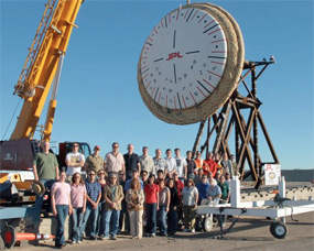
The hardware weighs less than two pounds and serves as a means of locating NASA’s flight imagery recorders that capture valuable image data of decelerators during deployment and deceleration. It’s a small box with a GPS receiver, satellite communications modem, batteries, and a dual band antenna.
NASA’s Jet Propulsion Laboratory, or JPL, sought the U.S. Army Research Laboratory’s help in “ruggedizing” a locator unit to limit the risk of losing this data, especially in the event of a catastrophic failure.
Missions to Mars are expected to grow in the future “... so NASA needs new technology to slow these big landers from hypersonic entry speed to subsonic ground approach speeds,” said Rex Hall, Electronics Technician, Army Research Laboratory, known as ARL, Project Lead Engineer; Flight Imagery Recorder Locator, or FIRLo. He said using atmospheric drag is a solution that would save the rocket engines and conserve fuel for landing.
In NASA experiments, large decelerators will be deployed at supersonic speeds and slow the vehicle to safer speeds for the crew and cargo. Hall said that NASA’s Jet Propulsion Lab, based in Pasadena, California, is leading full-scale stratospheric testing of these technologies.
“The parachute decelerators will slow the vehicle from Mach 2 to subsonic speeds,” he said.
The whole experiment is “floated” by a huge balloon to about 120,000 feet then released. A rocket motor is then fired and the Supersonic Inflatable Aerodynamic Decelerator is accelerated to supersonic speed.
“At about 180,000 feet in the air, the rocket motor burns out and the Ringsail chute is deployed. Shortly after the chute is deployed, the large Supersonic Ringsail Parachute is deployed, slowing the whole thing down until impact with the ocean once the experiment is over, or after a catastrophic failure,” said Hall, who spent 20 years at Wallops Island, a tiny NASA facility on the Eastern Shore of Virginia as a radio frequency and communication engineer before joining ARL in 2002.
Once on the ocean surface, ARL’s FIRLo unit will turn on and transmit a short-burst data transmission, containing location coordinates. This data’s location is imposed on a map. Coordinates can also be emailed to the experimenter.
“No specialized receiving equipment is necessary,” Hall said.
Time between transmissions is programmed prior to launch and can also be changed via satellite communication while the locator is floating. Battery status is also available in the transmission.
Hall said JPL used an iPhone to locate the FIRLo during a water recovery test this summer.
“The FIR was dropped about five miles off the Pacific coast and left to float for about four hours,” Hall explained. “The unit was successfully recovered. The prototype FIRLo was also subjected to a violent water surface impact test at JPL’s facility in Pasadena, California.
The locator was attached to a structure with the same mass and dimensions of the FIR, and was fired into a pool of water, 24 inches deep, at a velocity of over 70 mph. The FIRLo and simulator were supposed to hit the water sideways, but due to a failure of the slingshot-like launch device, the 60-pound structure hit the water, FIRLo first!”
ARL’s hardware can survive in excess of 10,000 g’s, is waterproof and will work when located only 12 inches from the ocean surface, and in temperature extremes below 35 degrees Celsius to 85 degrees Celsius.
The intent is for the FIR to be located and retrieved with specialized GPS receivers and other geo-location hardware that are being leveraged from similar technology previously developed at ARL for Army and Navy high-g guided projectile concepts. The FIR packages with geo-location hardware will be demonstrated in the first quarter of fiscal year 2014, with additional launches to follow.
The first prototype was given to JPL in September. ARL is currently building seven more to be delivered to JPL by the end of the month for use on other experiments.
ARL is supporting new requests for this hardware to support NASA’s Sounding Rocket Program tests at White Sands, N.M., and Poker Flats, Alaska, and additional testing in Pasadena, California, and off the coast of Kauai, Hawaii.
Story by T’Jae Gibson, Army Research Laboratory Public Affairs
* * * * * * * * *
General Dynamics C4 Systems + USCG—Rescue 21
The U.S. Coast Guard has conducted approximately 60,000 search and rescue operations since 2006 with support from the General Dynamics C4 Systems-built Rescue 21 system.

The nationwide command, control and communications system connects Coast Guard personnel with distressed mariners up to 20 nautical miles or more out to sea.
Rescue 21 is also interoperable with federal, state and local law enforcement and public safety organizations’ communications systems, increasing the Coast Guard’s effectiveness in accomplishing its missions, including critical homeland-security operations. Rescue 21 became operational in 32 of 37 U.S. Coast Guard Sectors by 2012; the first life saved by the system was recorded in 2005.
“In addition to being a life-line for millions of boaters, Rescue 21 is a model program that demonstrates how broadband technologies are improving maritime situational awareness, communication and collaboration among multiple government and law enforcement agencies,” said Chris Marzilli, president of General Dynamics C4 Systems.
On October 5, 2013, a Coast Guard watchstander in Sector Key West (Key West, Florida) heard an emergency call from a boat captain traveling from Naples to Key West. A fire onboard had severely damaged the boat’s radio and propulsion system. Before it failed, the radio operated just long enough to send a two-second “Mayday” call. Using position/location information generated by the Rescue 21 system, a C-130 search plane and Coast Guard rescue boat found the stranded mariner and returned the captain and his vessel to shore.
Rescue 21 comprises 253 towers and 32 command centers in full operation that cover more than 41,000 miles of U.S. coastline, lakes and rivers. When a distress call arrives, the system automatically records the call while direction-finding equipment on the towers accurately computes the call’s location, allowing search-and-rescue operations to begin immediately.
The system is also designed to accommodate additional sensors and command and control equipment as it becomes available, which will deliver new and cost-effective capabilities to the Coast Guard.
* * * * * * * * *
TSF—Offering Comms Aid To The Phillipines
Most would flee to escape its ravages, but Télécoms Sans Frontière (TSF) knew the potential dangers, and, nevertheless arrived in anticipation of its brutality... to assist with the results...after.
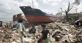
They arrived from Bangkok to the Philippines as a team to Visayas and Leyte in the Philippines on November 7th—the typhoon hit on November 8. The NGO’s team were well versed about Typhoon Haiyan (locally known as Yolanda)—a Category 5 typhoon with wind speeds of up to 300 km/h—the strongest tropical cyclone to make landfall in recorded history. The typhoon further destroyed areas of the Philippines which had already been weakened by two earlier typhoons and an earthquake in just this month—roads and infrastructures were seriously damaged and there was a high risk of further significant landslides.
The impact of Haiyan has been compared to that of the category 5 Typhoon Mike which hit the Philippines in 1990, causing more than 500 deaths and destroying almost 250,000 homes. TSF is able to provide immediate, essential support to hundreds of thousands of people affected as well as the numerous humanitarian aid agencies in the field. The reinforcements sent from TSF’s international HQ meant that victims of the storm would be able to make calls to their families to inform them of their situation, and, in many cases, to reassure them that they were still alive. Thanks to its partnership with UNDAC (United Nations Disaster Assessment and Coordination) TSF is one of the first NGO responders on the ground, allowing for telecoms assessments to be carried out as well as the immediate installation of telecoms centers to generate a coordination hub for the other NGOs in the disaster zone.
Being among the first on the ground after Haiyan struck, TSF was able to pre-position three telecom centers for relief coordination before the influx of humanitarian aid from other NGOs and agencies arrived. The town of Tacloban had been identified at the most affected area, with the head of UNDAC, Sebastian Rhodes Stampa, describing the area as having suffered “destruction on a massive scale.”
TSF had already installed three functioning satellite connections to provide Internet to the telecom centers—the first to do so, to the benefit of the Filipino NDRRMC (National Disaster Risk Reduction and Management Council) as well as the Ministry of Telecommunication; the second, for use by the United Nations agencies of OCHA, WFP and UNDAC; the third for all of the other humanitarian organizations present in the area.
As of this writing, as many as 10,000 people may have died in Tacloban alone, with hundreds more feared dead in the rest of Leyte and on neighboring Samar island. Many survivors have no clean water, electricity or food. More than 10 TSF’s centers have been established and they provide fielded NGOs with a management hub from which essential information can be sent concerning their operations and for effective coordination. Working in collaboration with local telephone operator, SMART, TSF has carried out assessments of the telecom situation and it is estimated that it could be as many as two months or more before the telecommunications networks are restored.
Security conditions across the Philippines did rapidly deteriorate. The critical need for food and water has lead desperate inhabitants to pillage supplies from shops and supermarkets, notably in the town of Tacloban. The Department of Health placed an official request for TSF to put into place a satellite connection within Tacloban General Hospital. The need for medical care borders on desperation. TSF’s satellite connection will allow for hospital workers to collaborate with medical teams on a national scale and provide well-coordinated health support to the thousands of victims seriously injured by the typhoon.
SMART and Globe Telecom have managed to partially restore GSM coverage in some areas of Tacloban. Pending the full operational service of the mobile network, TSF, alongside SMART, will continue to carry out their humanitarian calling operations.