
Space Systems Command (SSC) Surveillance and Tracking team participates in a real-world, multi-national exercise
A small team of Surveillance, Reconnaissance and Tracking (SRT) Guardians from Space Systems Command (SSC) recently participated in a real-world multi-national training exercise in South America that included some very real-life operations.
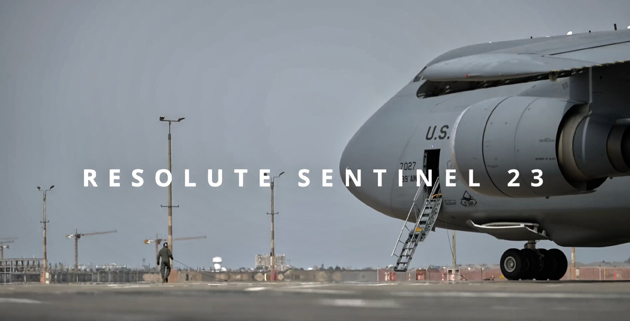
The SRT team was invited by the U. S. Space Command’s Joint Task Force-Space Defense Commercial Operations Cell (JCO) to Lima, Peru, to take part in RESOLUTE SENTINEL 23 (RS23), a U.S. Southern Command multi-national exercise, held earlier this year at the Centro Nacional de Operaciones de Imagenes Satelitales (CNOIS) from June 28th through July 8th.
Resolute Sentinel is a 12th Air Force (Air Force Southern)- led U.S. Southern Command (SOUTHCOM) exercise that was first held in 2021. Resolute Sentinel evolved out of the longstanding New Horizons and Beyond the Horizons, annual joint humanitarian assistance exercises in Latin America or the Caribbean.
Resolute Sentinel provides joint training and improved readiness of U.S. and partner nation civil engineers, medical professionals and support personnel through humanitarian assistance activities. Resolute Sentinel 23 was held in Peru and integrated combat interoperability and disaster response training, in addition to medical exchanges, training and aid and construction projects.
“I am overwhelmed by the professionalism of the combined joint space team,” said Lt. Col. Jonathan Whitaker, USSOUTHCOM Director of Space Forces. “Our hosts in Peru and Colombia gave us a worldclass opportunity to test operational aspects of the future Space Forces Southern Component Field Command. We exceeded every goal for this exercise.”
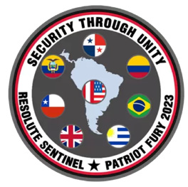
The four-member SRT team from SSC was joined by their counterparts from six allied nations — Peru, Colombia, Chile, Ecuador, Brazil, and the United Kingdom — for a total of 28 people participating, said Lt. McKenna G. Medina, SSC’s SRT site lead.
SSC’s SRT team used the exercise as a “sandbox” to test their ability to deliver useful Operational Planning Products (OPPs) to unified combatant command users at relevant timelines.
Currently, OPPs are commercially developed products that answer operational questions generated by the combatant commands. These products can be used to identify environments, such as maritime awareness, illegal fishing/resource extraction, or to highlight humanitarian issues.
“The best part about Operational Planning Products is that they’re non-classified,” Medina said. “They give users the flexibility to share commercial data with international partners.”
The SSC team contributed to two, real-world operations during the exercise. First, the team identified and geo- located a vessel suspected of illegally fishing in Peruvian waters. This led to SOUTHCOM tasking a USAF C-130 to over-fly the vessel and enabled Peruvian Coast Guard members to train on locating and identifying potential illegal fishing in their waters, said Lt. Col. Vinny Pande, SSC’s persistent tactical surveillance branch chief and a member of SSC’s SRT team. The illegal fishing OPP included historical tracks of potentially illegal fishing boats: ships that had turned off their radar and gone “dark,” among other details, Medina said.
Second, the team supported disaster planning by imaging a volcano that showed signs of a impending eruption in Columbia. SRT delivered commercial SAR-sensing products (a measure of radio frequency) to the Colombian government in support of humanitarian response planning. The team provided data from space showing status conditions of the Nevado del Ruiz volcano in Colombia compared side-by-side to data from a Peruvian volcano that had recently erupted, Medina said.
“This demonstrates real-world scenarios of space assets and commercial data capabilities to defend and protect land, sea and orbital,” Medina said. “Some of these countries are in the initial phases of using space to help them out. Helping them recognize that maybe we could was really cool.”
Capt. Benjamin L. Berezin, SSC deputy branch chief and SRT team member, added that it was eye-opening to see partner nation imagery applications as it gave the team’s analysts new avenues to work with partners.
The multi-national aspect of the exercise was ideal for validating that the OPPs could be released to partner nations in support of SOUTHCOM’s objectives, Medina said. Berezin noted that the facilities were state-of-the-art and allowed the SSC team to showcase their capabilities.
The CNOIS itself was built in the shape of the cupola, the European Space Agency-built observatory module of the International Space Station.
“I thought that was really cool and how we’re helping to provide that window into commercial space for the other nations,” Berezin said.
“They welcomed us with open arms,” Medina said. “It was really just a melting pot of everyone’s space expertise and gave us a good understanding of the use cases that we may support in the future.”
“This effort truly showcases the benefit of commercial technology to Combatant Commands and partner nations,” said Col. Minpo “Po” Shiue, Director, SSC’s Warfighter Integration Office. “As the news of SRT’s success spreads, we expect all Combatant Commands to seek out this capability. INDOPACOM has already expressed an interest to be the focus AOR (Area of Responsibility) for the next SRT effort.”
The SRT team, part of SSC’s Space Sensing program executive office, is now working on developing a six- month pilot program to assess AFRICOM’s needs for commercial sensing and analytics products.
“This is designed to help the combatant commands with their geographic priorities,” Pande said.
SSC@spaceforce.mil
Follow Space Systems Command on LinkedIn.