
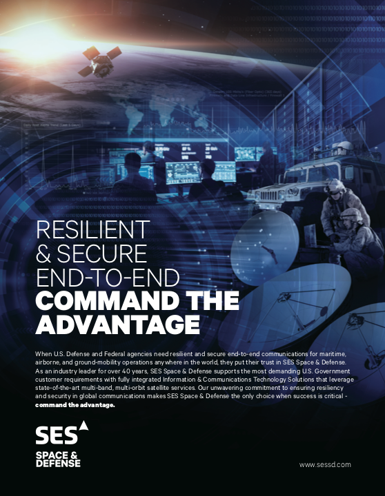
Creating a Unified, Global, Satellite Network to Power Joint, Multi-Domain Operations
In a keynote address at the I/ITSEC Conference, General David W. Allvin, the Vice Chief of Staff of the U.S. Air Force, told attendees, “…none of us is as smart as all of us. And the situation we find ourselves in — this country — is going to require just the very best of us all.”

Gen. Allvin’s sentiment was an eloquent way to say that the U.S. military will need to work as a single unit and not disparate services — and will need to work hand-in-hand with coalition and industry partners — if it’s going to be victorious in the battles of the future.

Gen. David. W.
Allvin
This is not the first time we’ve heard a senior leader from one of America’s military branches discuss the need for collaboration to ensure success against the near-peer adversaries of tomorrow. This has been one of the fundamental cornerstones of the U.S. Department of Defense (DoD) as it builds its future force for the year 2030 and beyond.
However, collaboration, integration, and interoperability in one domain, in particular, have long been a challenge for the military. In space, where allied and industry partners each bring their own constellations of spacecraft and ground networks, getting everything to work together remains a challenge. That challenge only grows more significant as the space domain continues to evolve from a benign domain into a warfighting domain.
To learn more about the need for interoperable space and ground networks as joint multi-domain operations become essential, GSR discussed this need with Ram Rao, the Director of Business Development Engineering, Technologies, and Solutions at SES Space & Defense. During this discussion, Ram was asked about the challenges that an austere space domain creates for the DoD, the technological challenges that the military faces when trying to integrate satellite networks with coalition and industry partners, and what some industry leaders are doing to make the seamless management of unified global networks a possibility for our military.
It’s apparent that the battles of tomorrow will cross domains — requiring capabilities to be delivered from the space and cyber domains to joint warfighters from the U.S. and its allies on land, in the air, and at sea. How do military networks become more complex and complicated when the space domain and space capabilities are added to the equation?

Ram Rao
Ram Rao
Correct. The U.S. DoD’s JADC2 framework is all about our warfighters and decision-makers from every service area — such as the Army, Navy, Air Force, Marine Corps, Coast Guard, National Guard, and now the Space Force — participating in and sharing quality data to make effective and timely decisions before our adversaries can act. Of course, this seems easy at a high level, but it’s very complicated to implement, albeit required. It is not a secret anymore that our adversaries — especially China and Russia — have been advancing and testing their space and cyber war capabilities in the last few years. In fact, they’ve been developing and testing these capabilities aggressively in the space domain over the past year.
____________________________________
“…the interaction between different
networks is not as integrated, automated,
or seamless. It’s often done through the
direct interfacing of circuits with VPN or
HTTPS connections. Or lower-tech, less
efficient methods are utilized – such as
email, DVD, or paper.” — Ram Rao
We have read about anti-satellite (ASAT) tests conducted by Russia and China that resulted in the destruction of satellites in orbit. We also have witnessed China grabbing its satellite from the GEO orbit and maneuvering into a graveyard orbit. It is obvious they are preparing and testing various capabilities that can enable them to deny our nation’s access to satellite connectivity. Capabilities like these have turned space from a benign environment into a warfighting domain
Warfighting in domains such as land, water, and air has existed for a long time. There have been hundreds or thousands of strategies and tactics developed in these domains that have evolved. The space domain is a new warfighting domain, and defensive and offensive c apabilities are still being developed and tested. Also, in space, there are no area limits or rules. The traditional warfighting domains have rules of engagement and occur in space-restricted arenas. Space is huge, there are no established rules of engagement, and the capabilities are still evolving. This makes the space domain much more complicated.
What impact does the introduction of commercial satellite services have on the resiliency and assuredness of space capabilities?
Ram Rao
The DoD figured out long ago that the commercial industry and the integration of COMSATCOM services into their MILSATCOM solutions is crucial for mission-critical capabilities. I believe that integrating LEO, MEO, and GEO capabilities from the U.S. military, allied militaries, and commercial partners is a massive deterrent to our adversaries.
These capabilities tremendously increase our resiliency in space and on the ground, making it difficult for adversaries to deny our satellite capabilities. The high speed, high bandwidth, low latency, and pole-to-pole coverage that COMSATCOM can provide is unparalleled and well-positioned for integration with MILSATCOM.
What challenges does the added complexity of integrating multiple satellite resources and services create from a network transparency, assurance, and management standpoint?
Ram Rao
There are multiple challenges. But the government and its industry partners are well aware of these challenges and are working collaboratively to solve them.
When we say COMSATCOM and MILSATCOM, we’re not just referring to two disparate networks. We are talking about hundreds, if not thousands, of disparate networks that need to be integrated worldwide.
Network transparency, assurance, and management require agreed-up visibility and a standardized network interface. For example, the U.S. Space Force Enterprise Management & Control (EM&C) system requires network management systems from different DoD and commercial networks to be integrated at different levels.
That is a challenging task. Every participating COMSATCOM netwo rk may not follow the same standards. Also, when we start integrating the satellite capabilities of allied and coalition nations, we have to expect that different countries may follow different standards. Assurance requirements for all countries are not the same.
It’s difficult to ensure that various networks align on multiple requirements, including access levels. However, leading COMSATCOM industry players like SES Space & Defense have the infrastructure, capability, and experience necessary to integrate and operate as a part of a global military network.
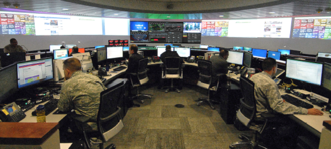
How is the visualization and management of the whole military network – including military and commercial space assets and capabilities — done today? What tools exist that enable the military to see and manage everything?
Ram Rao
Most individual networks with their network management systems (NMS) have required visualization and management capabilities. However, the interaction between different networks is not as integrated, automated, or seamless. It’s often done through the direct interfacing of circuits with VPN or HTTPS connections. Or lower-tech, less efficient methods are used — such as email, DVD, or paper.
Not only is this laborious, but it doesn’t move at the pace of battle. Speed of delivery — especially during warfighting times – is a top priority for every military decision-maker.
____________________________________
“The DoD figured out long ago that the
commercial industry and the integration of
COMSATCOM services into their
MILSATCOM solutions is crucial for
mission-critical capabilities. I believe that
integrating LEO, MEO, and GEO
capabilities from the U.S. military, allied
militaries, and commercial partners is
a massive deterrent to our adversaries.”
— Ram Rao
A number of tools and platforms are being developed and introduced across the industry that provides a unified view of the network. Solutions such as the Information & Communications Technology (ICT) Portal by SES Space & Defense provides transparent and consolidated network visibility improving performance and operational decision that can enable military users to see their entire network —– including space and ground assets — on a single pane of glass. This new solution gives the military transparency into everything on their networks and allows for the easier management and operations of both terrestrial and space network assets and capabilities.
You talked about the sheer number of different space and ground networks that the DoD needs to see and manage as they work to integrate their own space assets with those of coalition and industry partners. How does the lack of a single, all-encompassing view of the network impact the military’s ability to manage its networks to overcome denied or disrupted capabilities or services? How does this impact the warfighter in the field?
Ram Rao
I have heard every high-ranking official in our military discuss the need to increase the speed of delivery and the speed of operations. But to accomplish this, they need end-to- end communications and data-centric global networks.
They are also looking to reduce the latency in satellite networks from the 600ms offered by satellites in Geosynchronous Orbit (GEO) to the 150 to 50 ms offered by satellites in Lower Earth Orbit (LEO) and Medium Earth Orbit (MEO).
Timing is everything for warfighters. It’s no surprise that our adversaries are working towards pursuing efficient delivery capabilities. To The U.S. DoD’s JADC2 framework is all about our warfighters and decision- makers from every service area…participating in and sharing quality data to make effective and timely decisions before our adversaries can act. Of course, this seems easy at a high level, but it’s very complicated to implement, continue to compete and win in the future, we need to remain faster and more effective despite their efforts.
Global integration of our networks is crucial for seamless connectivity from one end of Earth to the other through various space and ground connections. The lack of a unified network will significantly and adversely impact the speed at which we deliver information and capabilities to warfighters, drastically reducing their effectiveness. However, with an integrated, resilient network – and agreed-upon access – there should not be any denials or disruptions.
____________________________
“The U.S. DoD’s JADC2 framework is
all about our warfighters and
decisionmakers from every service area…participating in and sharing quality data
to make effective and timely decisions
before our adversaries can act. Of course,
this seems easy at a high level, but it’s very complicated to implement, albeit required.”
— Ram Rao
What is the Information & Communications Technology (ICT) Portal? What was the initial concept and intention for the portal? What tools or capabilities does the ICT Portal give to military and government users?
Ram Rao
The ICT Portal is a flagship capability SES Space & Defense offers to customers and mission partners as a part of the company’s network solutions. The ICT Portal is a web- based NetOps set of tools providing end-to-end situational awareness in a consumable “single pane of glass” user interface. The consolidated network visibility provides our mission partners something they generally don’t have with COMSATCOM networks — a near real-time view into the network.
Even when COMSATCOM networks work in tandem with MILSATCOM networks, the ICT Portal gives users a view of their space segment, teleports, gateways, hubs, and terrestrial circuits – all the way to the individual user terminals.
The ICT Portal offers users five views into their network – each with multiple capabilities. These capabilities and functionality include an operational dashboard, terminal console, capacity management tool, and reporting tools. Within each capability view are a variety of sub-views, each with dozens or sometimes hundreds of data points to observe, filter, and use to improve the understanding of the SATCOM network.
SES Space & Defense’s intention has always been to support our mission partners with capabilities that deliver complete visibility and transparency into their networks and provide the situational awareness required to make timely, informed decisions.
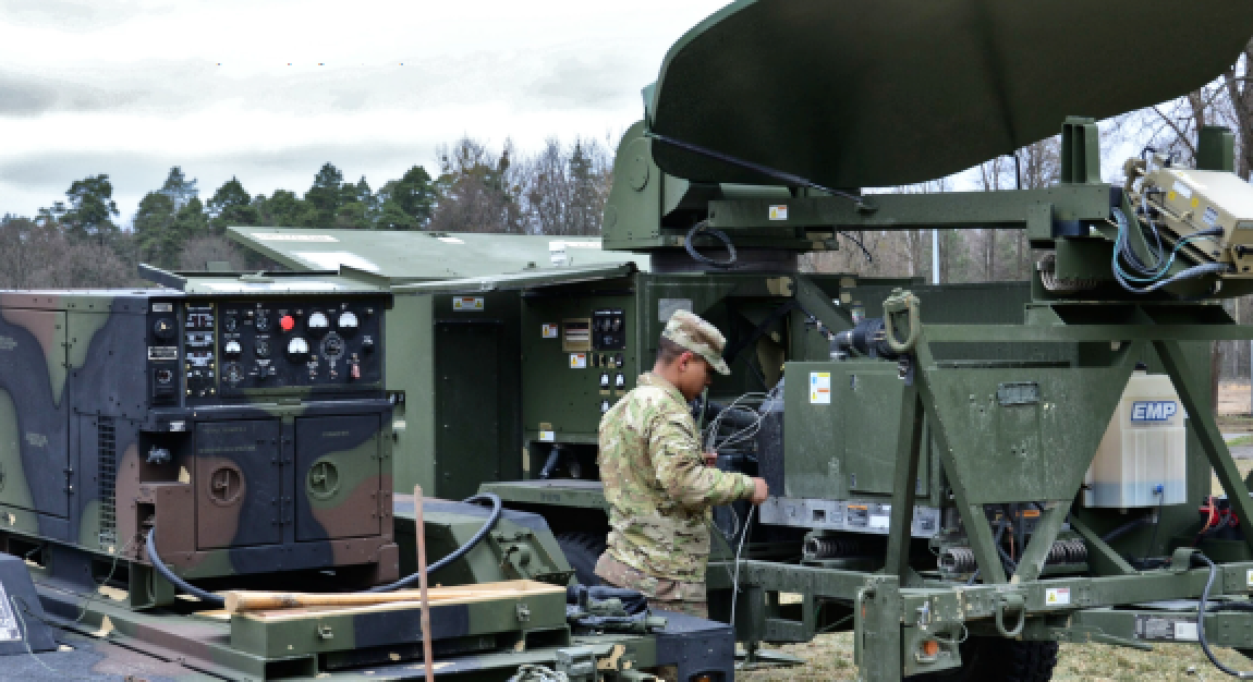
U.S. Soldiers from the 2nd Stryker Cavalry Regiment, set up a Satellite Transportable Terminal (STT) system at Orzysz, Poland. The STT is an optimized, over-the-horizon communications system ideally suited for tactical communications missions. (U.S. Army photos by Charles Rosemond, Training Support Team Orzysz)
Can you provide an example of how and why the ICT Portal could be useful to the military doing a mission or operation? What could it enable them to do?
Ram Rao
Our ICT Portal’s satellite coverage overlays allow users to see both EIRP and G/T maps of the satellite coverage in their network. The intent of this capability is to show users their satellite coverage within the deployment area.
This enables them to know — before they deploy — the minimum terminal specification required in that location. For example, if they are in the 50 dBW contour, they will need a minimum of a 1.2 meter antenna with a four-watt BUC. Users can also select multiple footprints to see where they have overlapping or redundant coverage. This capability immensely helps quick and efficient planning.
____________________________
“Our ICT Portal’s satellite coverage
overlays allow users to see both EIRP
and G/T maps of the satellite coverage
in their network. The intent of this
capability is to show users their
satellite coverage within the
deployment area.” – Ram Rao
Another useful example is the company’s VSAT Point Assist tool. While it is best practice to always do a site survey prior to deploying a VSAT terminal, we understand that it’s not always possible for DoD missions. The VSAT Point Assist tool provides field techs with a way to do site surveys virtually.
The VSAT Point Assist tool allows users to input a location and choose a satellite. It then generates an estimated pointing angle and provides other necessary information, such as elevation and azimuth angles. Users can also drag the icon to different locations to ensure a clear path to the satellite.
The goal is to enable the military to conduct site surveys without a physical presence in theater and save significant time and costs while allowing them to better prepare for missions in advance.
Another useful example I’ll share is the ICT Portal Weather Overlay capability that offers more than 150 different options of illustrating near real-time, historical, and forecasted weather information. This tool allows users to select as many of these events as they want and add them to the active list — such as active fire points, lightning strikes, tropical
cyclones, and other live weather events. They can even see hurricanes and their paths.
These overlays are essential to improve situational awareness for our warfighters. It allows them to visualize how rain, snow, or ice may affect satellite connections and identify any alternatives they may have.
Is the ICT Portal available now? If not, when will it be available? Also, who will be able to use this offering?
Ram Rao
The ICT Portal is available for SES Space & Defense network customers and is being used by some of the firm’s current government partners.

We are continually working with our customers to improve and expand the capabilities of the ICT Portal. We have an extensive road map to add new capabilities and features to the ICT Portal, including AI/ML (Artificial Intelligence / Machine Language) capabilities, a complete cyber monitoring package, and fully customizable reporting packages. We also plan to enable select mission partners to control portions of the network as needed for critical mission success.
To learn more about the SES Space & Defense ICT Portal, or to request a demonstration, select this direct link...

Ryan Schradin
This article first appeared on GovSat and is republished with permission of SES Defense and Space and GSR.
Ryan Schradin is a communications expert and journalist with more than a decade of experience, Ryan has edited and contributed to multiple popular online trade publications focused on the satellite, unified communications and network infrastructure industries. In addition to editing content and establishing editorial direction, Ryan also contributes articles about satellite news and trends and has also conducted written and podcast interviews for GovSat.